
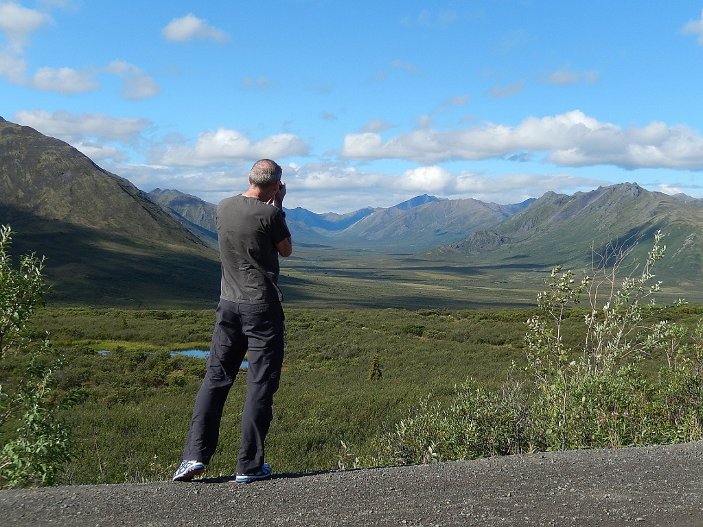
 1) G took this awesome photograph of me photographing the Tombstone Mountains 100kms up the Dempster Highway
I came to the start of the Dempster Highway with a pre-conceived notion of what to expect: a treasure trove of scenic spots in/around the Tombstone Mountains and then 600kms of tundra with anemic trees. What I found was astonishingly different: a plethora of distinct and varied ecoregions; three unique mountain ranges; trees all the way up to Inuvik; villages with welcoming residents proud to share their perspectives on “The North”; jaw-dropping, beautiful vistas; and moments where, alone on that road, in all its vastness, you learn something of what it is to be Canadian and how vital the North is to our identity.
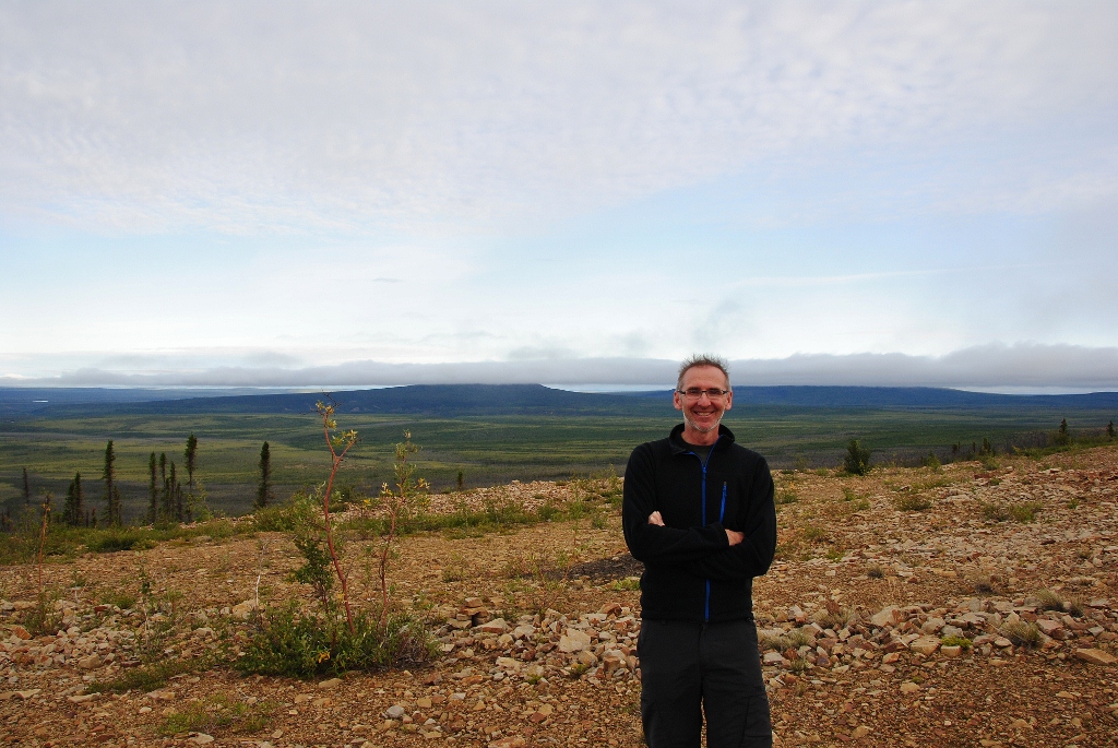
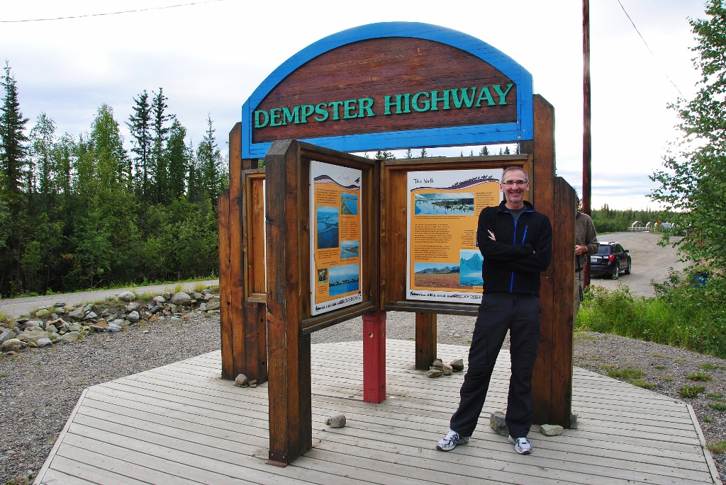 2) here I am at the start of the highway
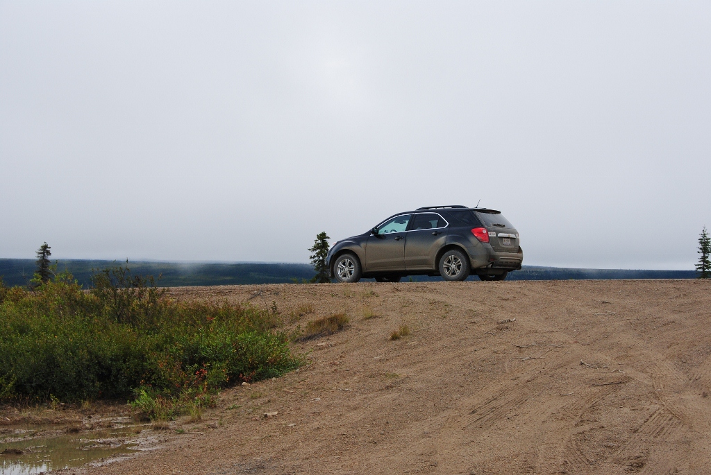
 3) here’s our car ready to rumble … just over that bridge the pavement ends and it’s a gravelly, bumpy road from there to Inuvik
 4) away we go …
 5) … but not before taking note of this
 6) heading towards the Tombstone Mountains
 7) a couple hours in, you reach the park
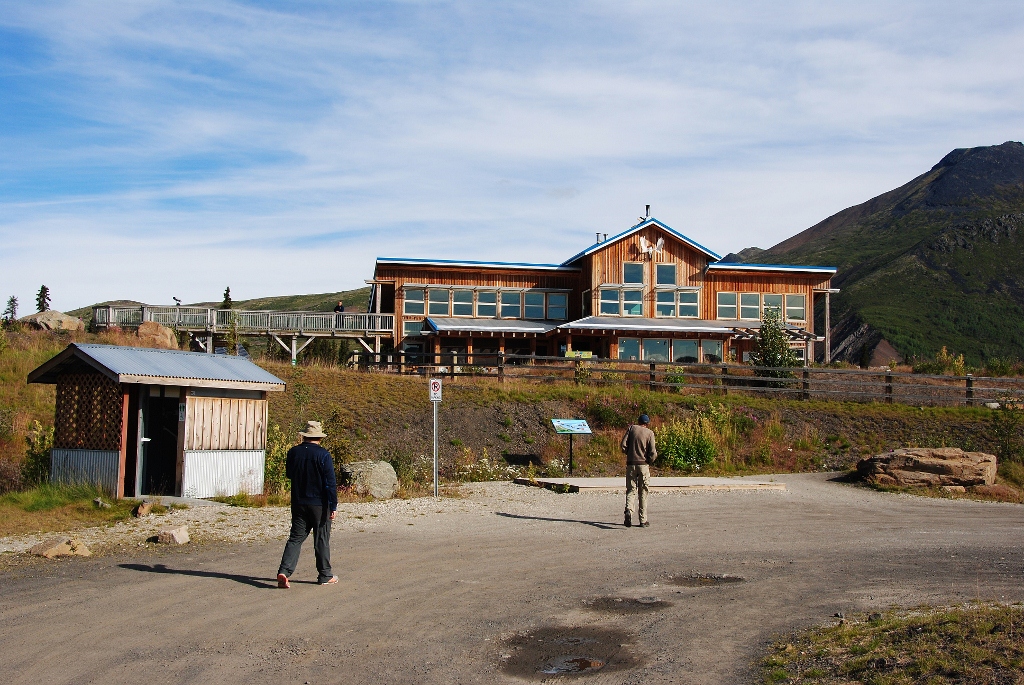 8) and the interpretative centre where we stopped to get an update on bear activity before venturing out to hike
 9) the ranger said all was good so out we went for a hike
 10) isn’t the gaggle of arctic growth pretty
 11) spectacular scenery!
 12) beautiful vistas everywhere
 13) so pretty
 14) if you double-click and view this picture in full size, you’ll see the road we’ve travelled way off in the distance
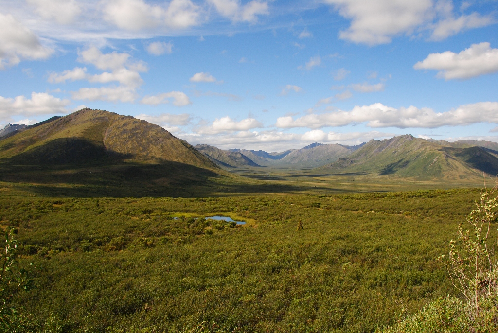
 15) here is Two Moose Lake (we saw no moose though) in what is called the Blackstone Uplands where we stopped for lunch; in the background is the Oligvie Mountain Range
This section of the Highway – in between the two mountain ranges – was very familiar to early travellers. It served as a winter crossroads for Han and Gwich’in peoples who shifted their camps seasonally. Way back in the winter of 1904-05, the Royal Northwest Mounted Police (the precursor to today’s RCMP) began winter patrols between posts at Dawson City, Fort McPherson, and believe it or not, Herschel Island waaaay up on the Beaufort Sea. Those patrols took 50 days. The route was made famous by the “Lost Patrol” who in 1910-11 disappeared while travelling south from Fort McPherson. This particular patrol, led by Sergeant Fitzgerald, headed out without a First Nations guide and lost their way near Little Wind River. All members, sadly, died while attempting to return to Fort McPherson.
 16) the Oligvie Mountains are very different from the Tombstone Range … far more bald and barren
 17) the rivers through the Oligvie Range are stained red; the result of the water percolating through limestone, gypsum, salt and sulfide-bearing sediments which dissolves the rock. Do not drink this water as it is highly acidic!
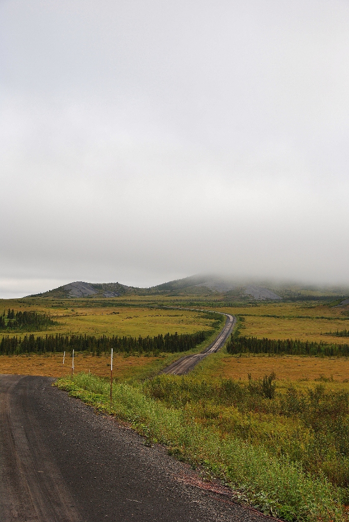
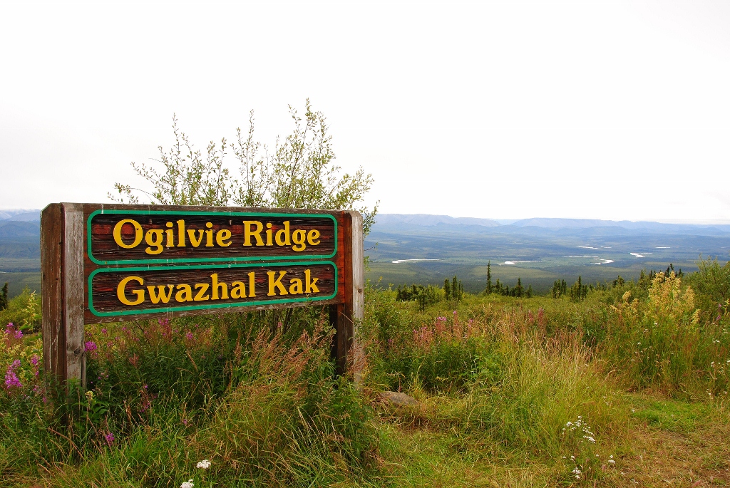 18) at kilometer 259 you’ll arrive at the Ogilvie Ridge viewpoint
 19) where you can look back south to the mountains you’ve just crossed and the Peel River
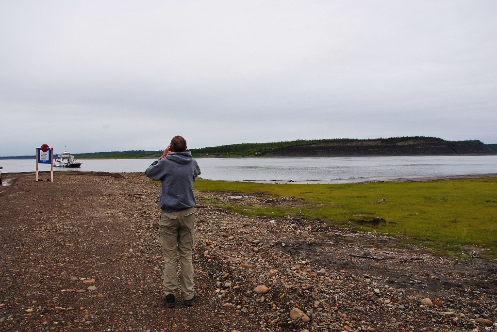
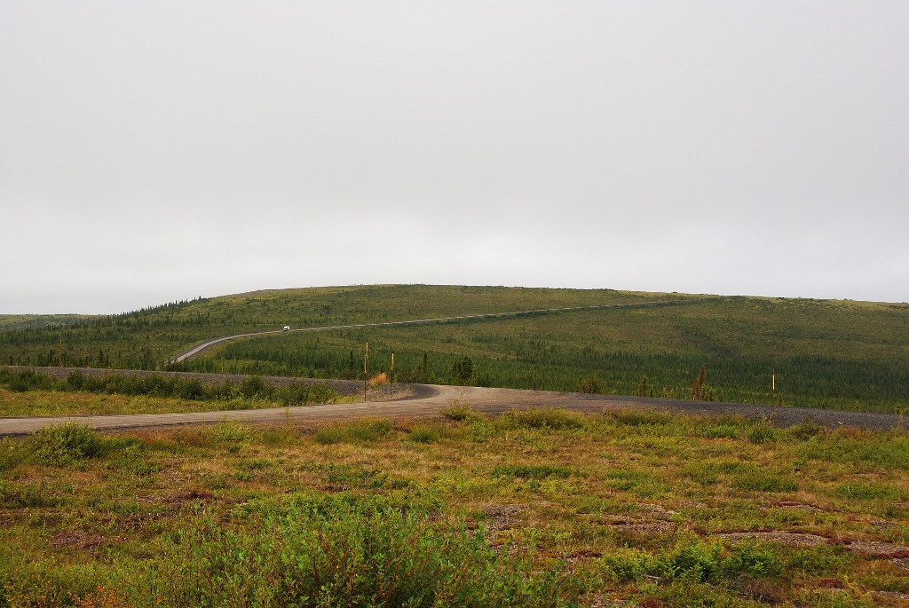
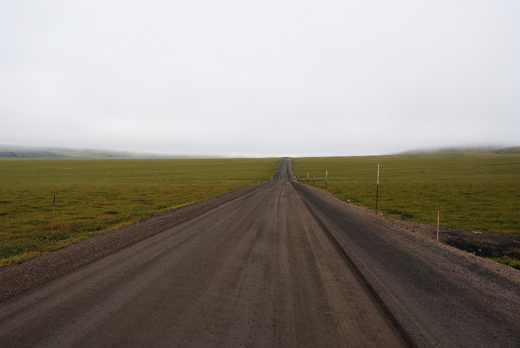
 20) for many kilometers here – on a very rough road! – you move along a transition line between scrub and tundra
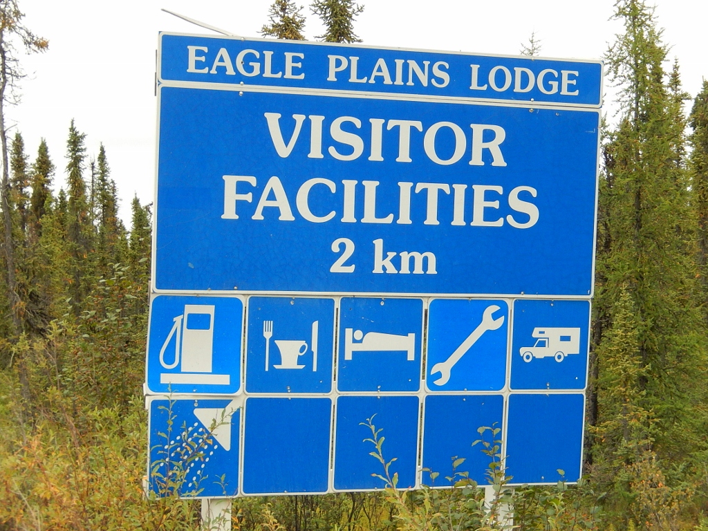
Some 8 hours later and 369 kilometers along, you reach Eagle Plains and the Eagle Plains Lodge: an oasis quite literally in the middle of nowhere. The lodge has a garage, petrol station, hotel and restaurant and is where we spent the night. It was constructed by the government in 1978 on a spot where the challenges of building on permafrost were solved by a small area of exposed bedrock.
 21) yay! we’re almost there!
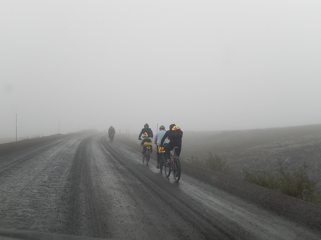
 22) made it!
 23) here was home for the night; very basic but very clean
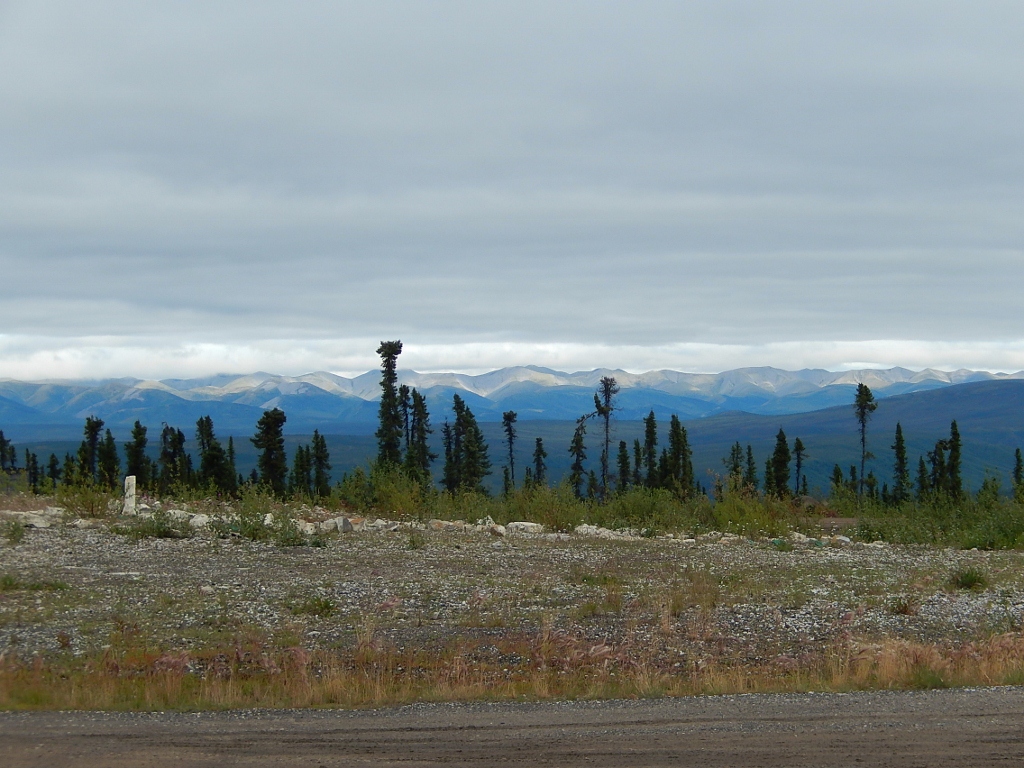 24) the next morning before heading out we take a look Richardson Mountains which are next up
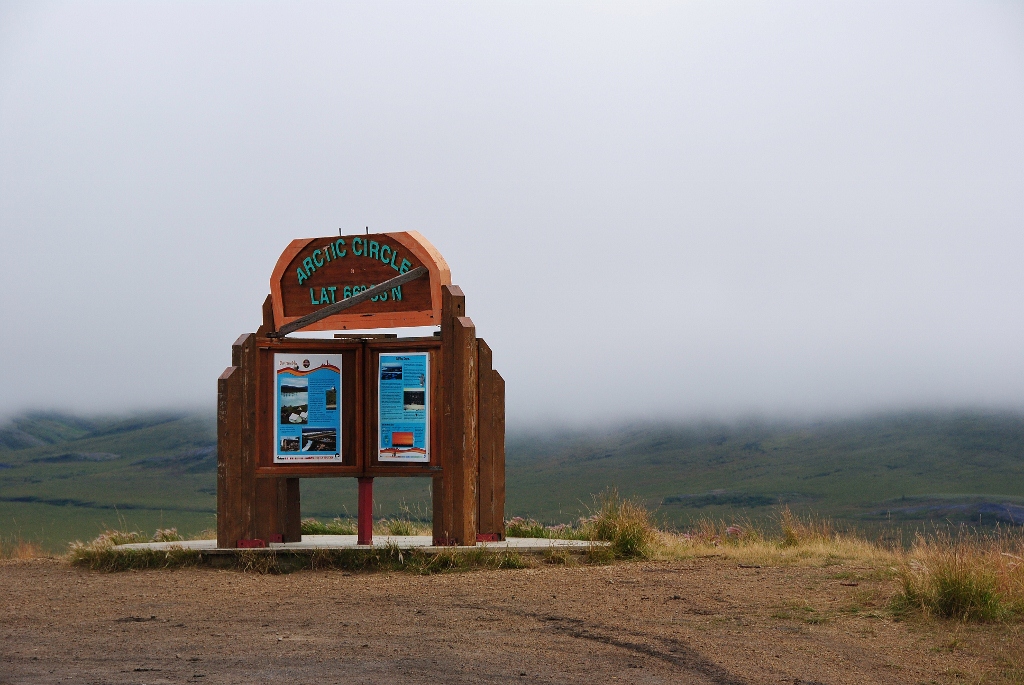 25) at kilometer 405.5 we arrive at 66 degrees 33 minutes (aka the Arctic Circle); here at midnight on June 22, the sun never falls below the horizon and the long days of the midnight sun begin
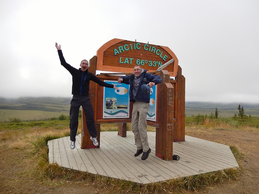 26) SO happy to be here!
 27) with but one other vehicle anywhere around us
 28) the view at the arctic circle was foggy, sadly
 29) but we had a ground squirrel to keep us entertained
 30) onwards to the Northwest Territory border we drove
 31) look at how lonely that highway looks ahead of us!
 32) me looking happy to be here
 33) our now dirty car. Interestingly, on the road we saw on Day 1 – 12 cars going north; 30 heading south and 2 cyclists; on Day 2 – 11 cars going north; 24 heading south and 15 cyclists
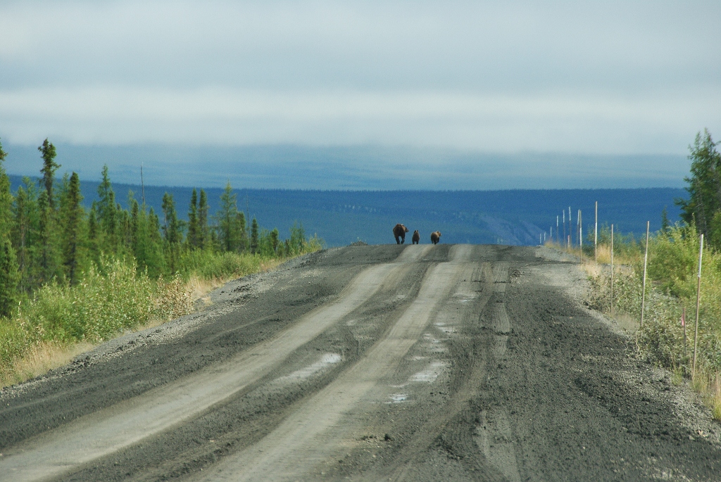
 34) into bear country
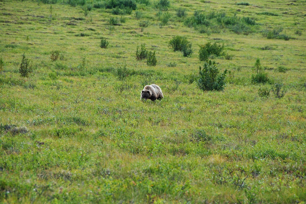
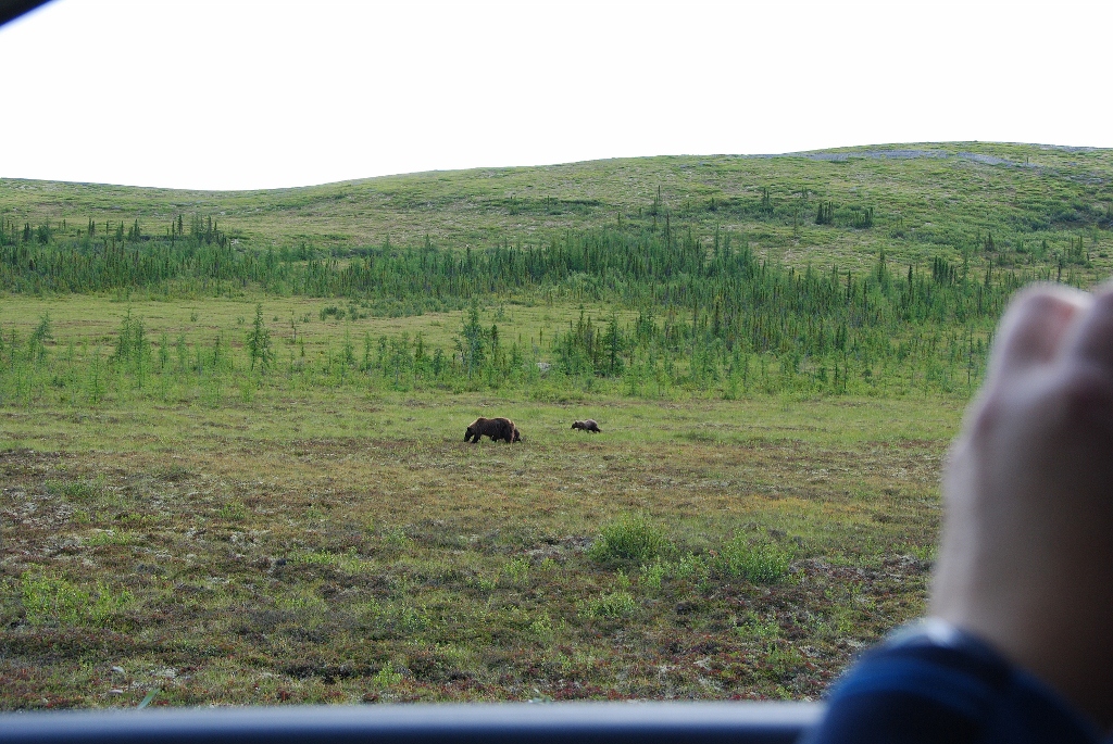
In summer the great caribou herds are gone (they move up north closer to the sea) but the grizzly bears remain. Most of the Dempster is grizzly country and it was along this stretch that eagle eye Papa first sighted a bear: a male wandering just off the highway munching on berries. Further up the road we came across a female and two adorable cubs who were right on the road. We then followed them as they walked alongside the highway but 10 metres from us. So neat!
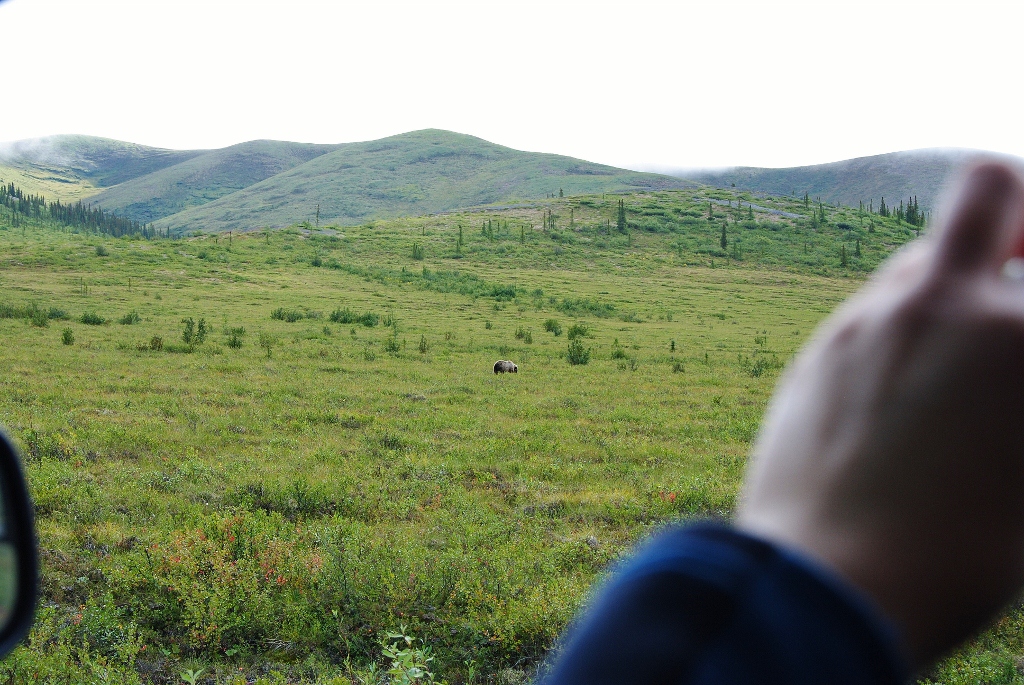 35) Papa first sighted this male grizzly
 36) I snapped him with my telephoto lens
 37) and then up the road a bit, the female and two cub right on the blessed road!
 38) so we followed them awhile as they drew nearer the roadside
 39) here they are
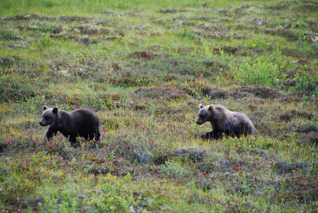 40) the cubs are SO cute
 41) the mom then was right beside us playing with a log she found
 42) OMG, look at her claws … ouch!
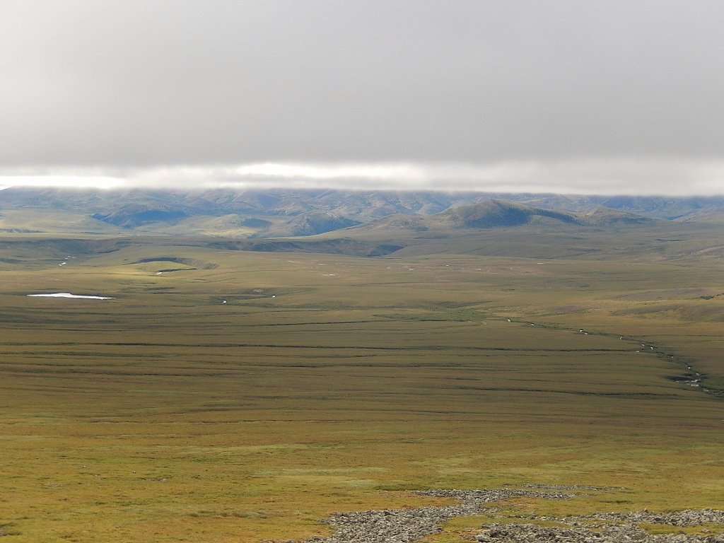
 43) now moving close to the Northwest Territory border and the landscape is one scrapped clean by the great Laurentide Ice Sheet thousands of years ago
 44) arriving at – and atop – the Northwest Territory border. It was chilly up here
 45) and would you believe, way out here in the middle of no where, this troop of cyclists!
 46) they’ve another 270 km to go to reach Inuvik though!
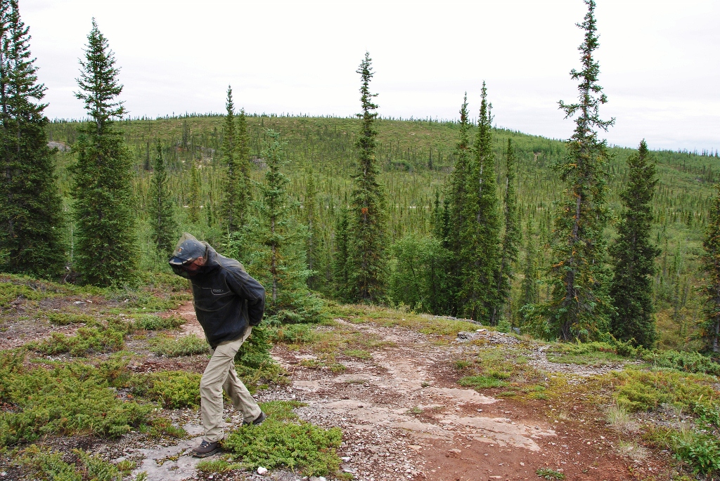
 47) I found this stretch of the drive through the Vittrekwa Valley utterly gorgeous
 48) so beautiful!
 49) descending from the gorge
 50) almost down
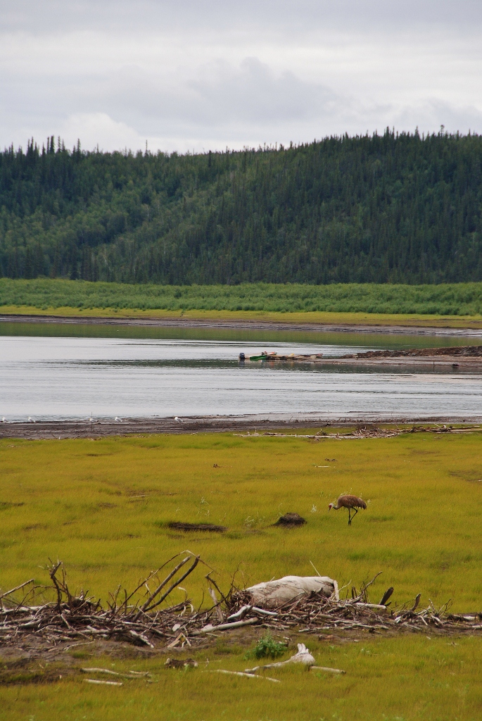
Leaving the Richardson Mountains, Vittrekwa Valley and the gorge behind, we broke out into the vast expanse of the Peel River plateau and the start of the Mackenzie Delta. Two river crossings now lay between us and Inuvik.
 51) the view from the Peel River Plateau
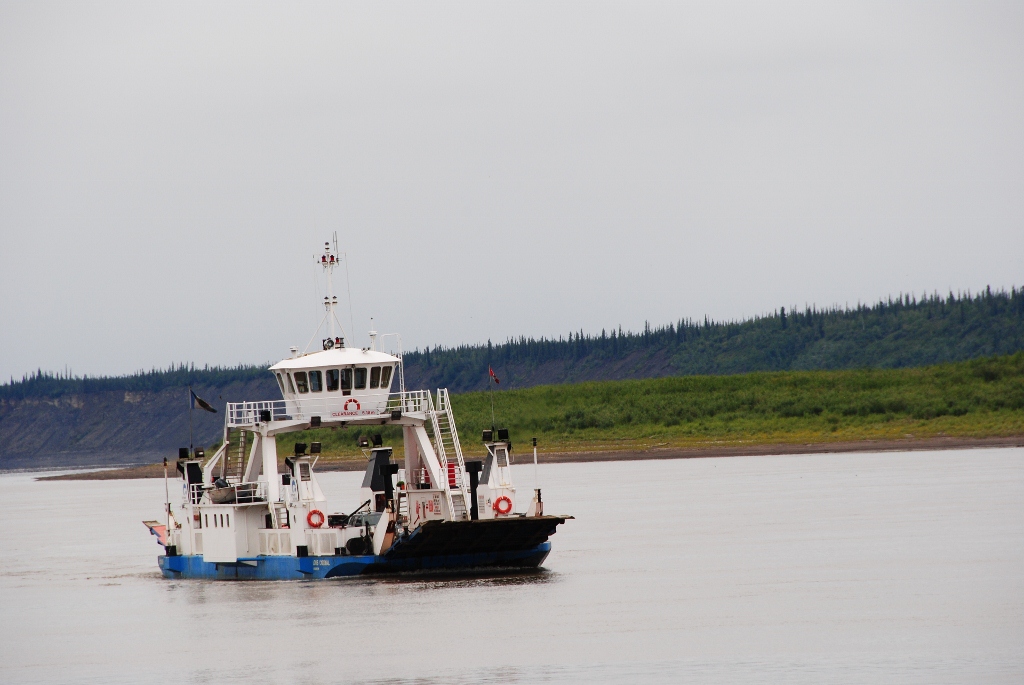
 52) 1st crossing is the MV Abraham Francis crossing the Peel River near Fort MacPherson
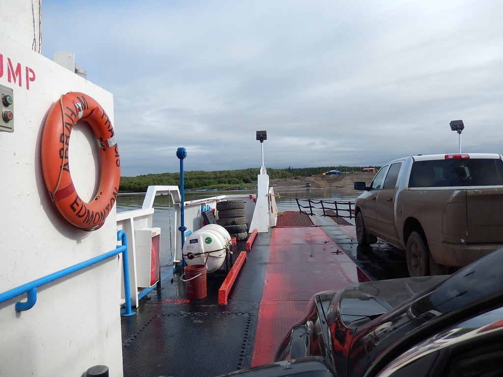 53) aboard ship (both ferries are free)
 54) arriving in Fort McPherson, world-famous for its Fort McPherson Tent and Canvass Company
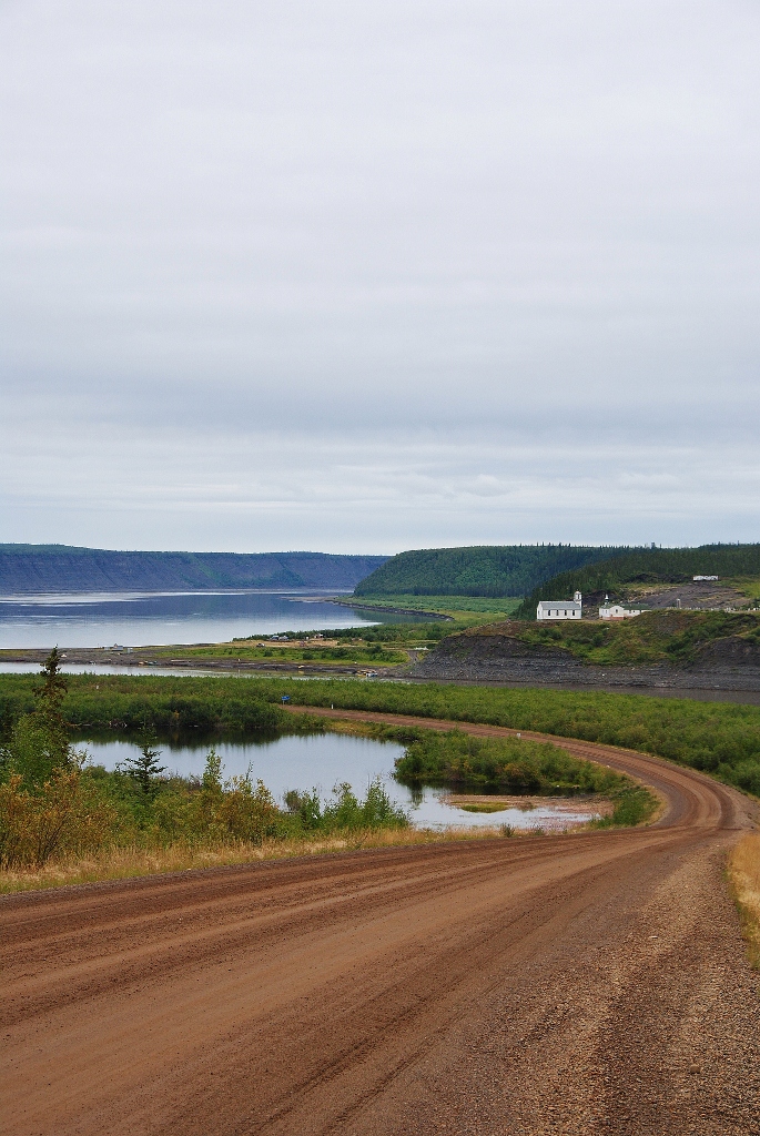 55) the MacKenzie River crossing at Tsiigehtchic
 56) Papa gets a closer look at the MV Louis Cardinal ferry crossing near Tsiigehtchic on the MacKenzie River
 57) along the shore
 58) more along the shore
 59) here comes our ferry
 60) just outside Inuvik, we’re amazed at the vegetation this far north; we head out for a hike at the Tithegeh Chii Vitaii lookout
 61) despite being warned about how horrible the bugs would be this is the first place we’re forced to don our bug net headwear (as you see Papa wearing here).
Built in 1955 as an administration centre in the Western Arctic, Inuvik is an Inuvialuktun word which means ‘place of man’. It is the largest centre above the Arctic Circle in Canada with a population of some 3,400 hardy souls. I really like Inuvik and found it to be far more ‘developed’ and ‘civilized’ than my mind’s eye had thought. There is a great hotel there, the Mackenzie Hotel with super food; a sort of combined grocery store/Wal-Mart called NorthMart. We made home during our stay at Capital Suites which was simply outstanding (front desk receptionist aside).
Because the town is built on permafrost, all its buildings are constructed on pilings … as is the town’s water and sewage network which makes it quite unique. There is a mosque and the famous Igloo Catholic Church and if you visit Town Hall, the Mayor will be happy to give you a free lapel pin.
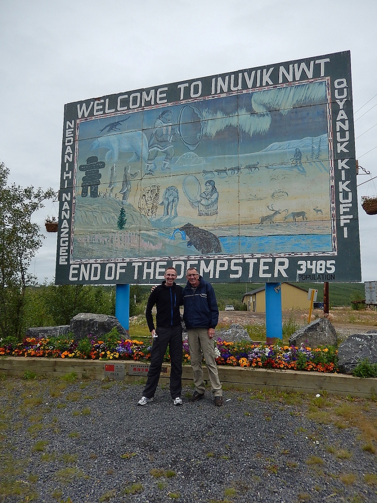 62) papa and I at the end of the road
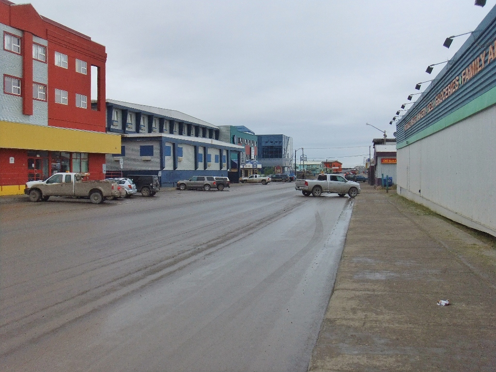 63) outside NorthMart on Mackenzie Road, the main street of the town
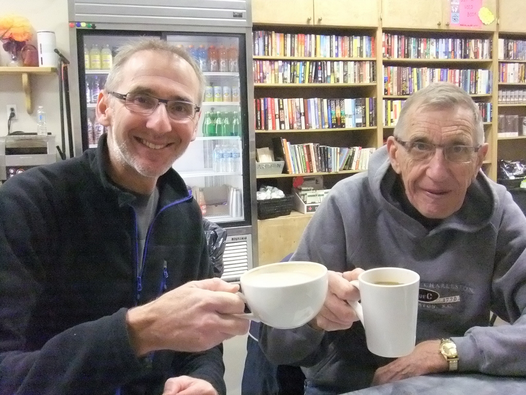 64) cheers, a coffee before our trip to Tuktoyaktuk
 65) G heads out to tour – the Mackenzie Hotel is straight ahead
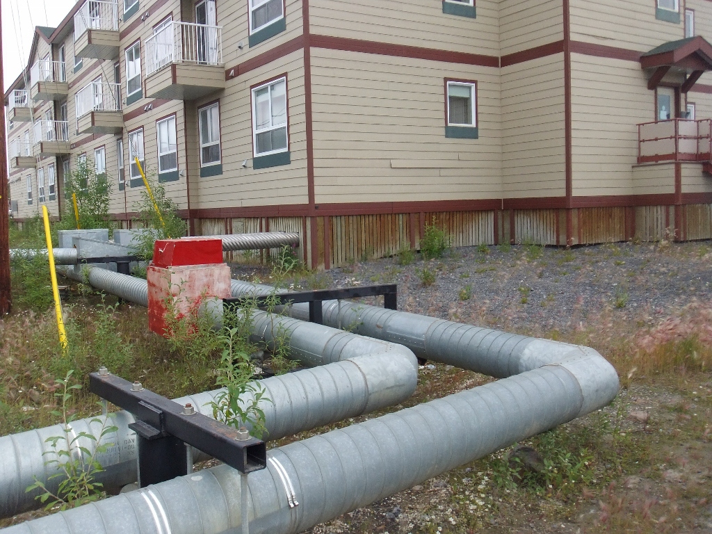 66) here is the water and sewage lines heading into our hotel
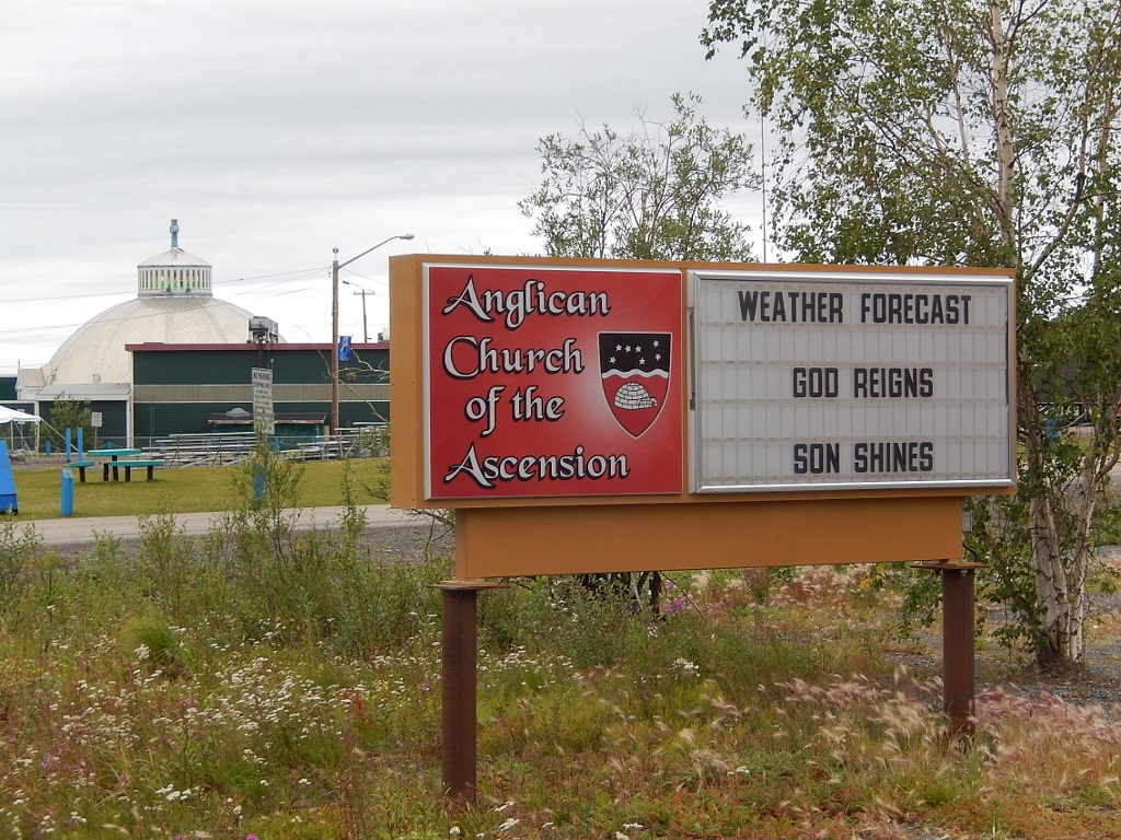 67) this sign is good to know! … you can see the Igloo Church in the background
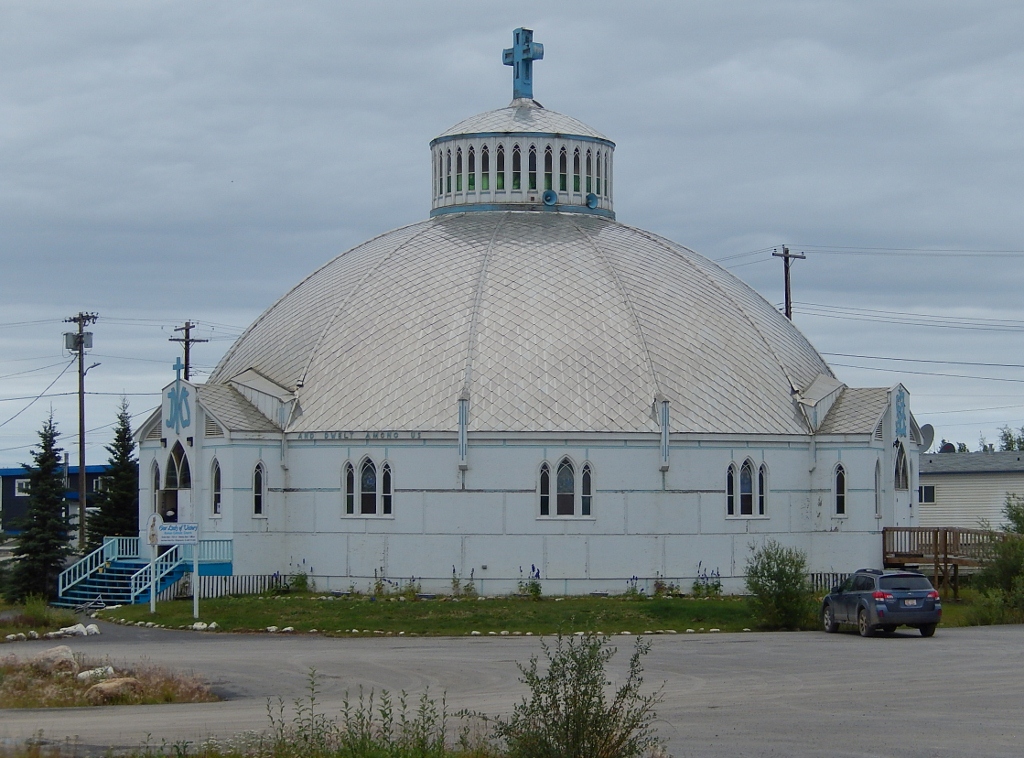 68) here it is
 69) so cute!
 70) a look inside
 71) ordering up dinner in the Mackenzie Hotel
 72) here’s a photo from our hotel taken at 1AM in the morning
 73) and a second photo taken at 4AM in the morning … surreal eh!

The pictures and commentary are awesome, I want to go back !!
Thanks for taking me on a trip of a lifetime. The memories will be with me always and forever.
Love
Papa.